Quiet Forecast Ahead After This Morning’s Showers
Roughly Average Temperatures Through Next Weekend
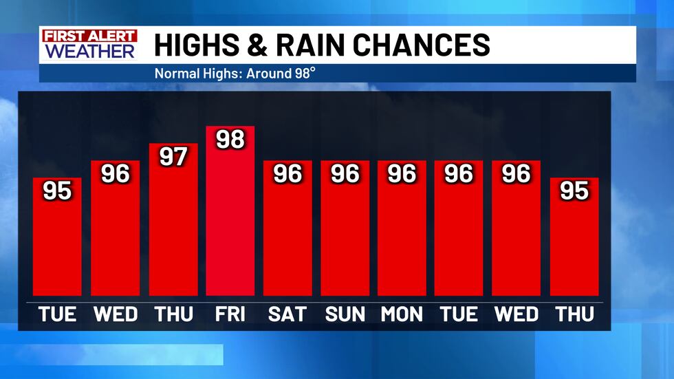
There is no doubt that some Central Texans awoke to some loud and windy thunderstorms early Monday morning, but thankfully, these storms largely behaved themselves! We have yet to see any wind damage reports from earlier this morning, so that is great news - the storms today have largely gone as expected. Temperatures this afternoon have fallen a good 5 to 10 degrees below where they were yesterday, but enjoy it while it lasts...the high pressure ridge builds in (again), effectively cutting off any rain chances and warming us up through next weekend.
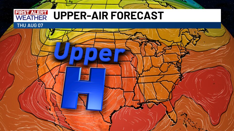
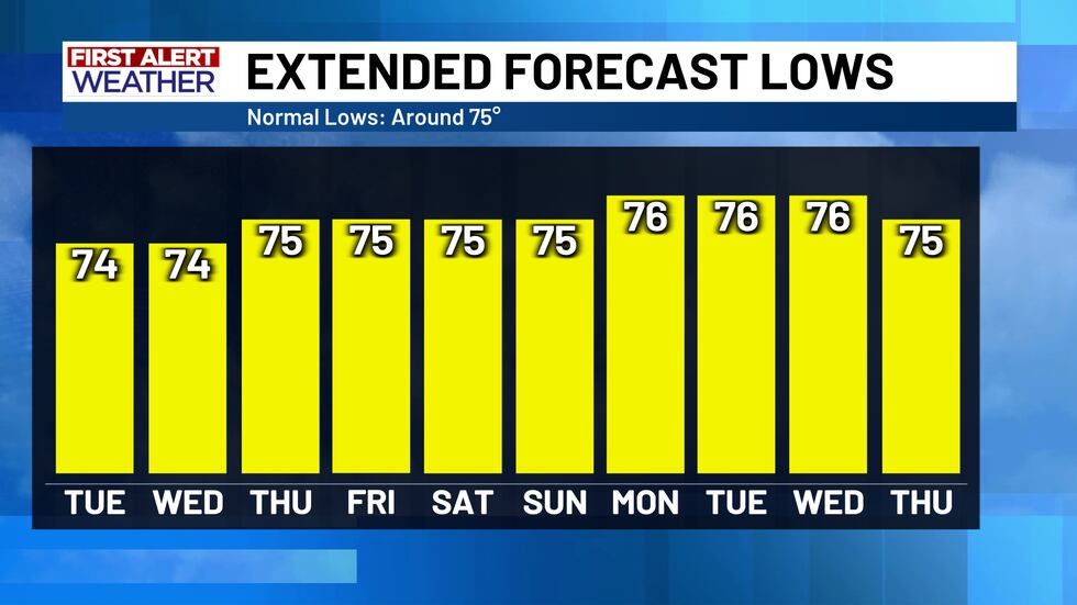
Normal high’s during the next 10 day stretch (August 4th - 14th) usually hover around 98° and lows usually around 75°. This is exactly where we are expected to settle by Thursday and into the weekend.
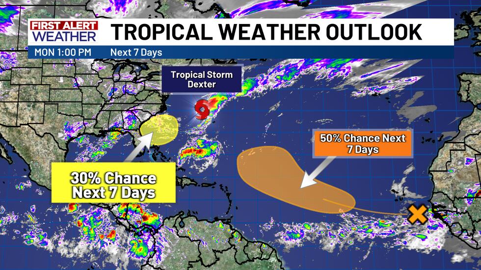
The Atlantic Basin has started to pick up in terms of tropical activity, but nothing is expected to impact Texas in the near future. Most tropical activity as of right now is expected to remain over open ocean, including Tropical Storm Dexter. The one thing that could impact the Gulf coast is a tropical wave that is getting going off the African coast...but it is simply too early to determine where this will head at this time. That wave has a 50% chance of developing in the next 7 days. Behind Dexter, another tropical low has a 30% chance of developing off the eastern U.S. coast in the next 7 days.
Copyright 2025 KWTX. All rights reserved.


