Settling Into a Spell of Great Weather in Central Texas, but Activity is Heating Up in the Tropics
One Storm Could Impact the U.S. East Coast...
We are looking to be very consistent over the next several days with lots of sunshine and nice fall-like temperatures. With highs in the upper 80s and lows in the lower 60s expected for the next week or so, if you love the great outdoors now is the time to go take advantage of this weather. But, even though things are quiet here in Central Texas, we are keeping an eye on the tropics as lots of activity is brewing in the Atlantic, some of which could impact the U.S. in the coming days.
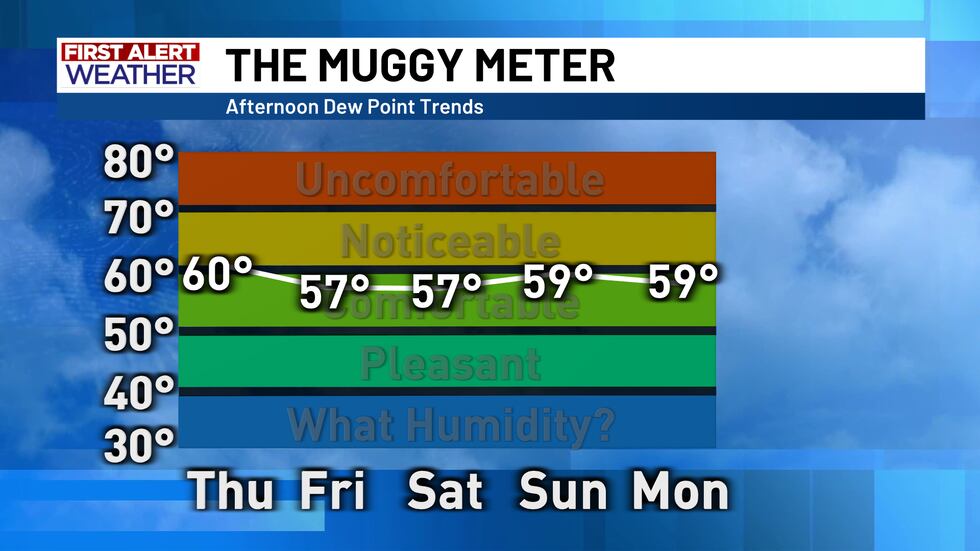
A center of high pressure here at the surface is located across parts of the panhandle and into eastern New Mexico, and as the winds wrap clockwise around it, drier and drier air is being pushed into our area from the north and northwest. This drier air will make humidity be a non factor in how it feels outside, it will also help to cool us off further in the evenings and overnight hours so morning lows will be lower as this drier air can hold less heat throughout the overnight hours.
We will be stuck in this pattern (which is in no way a bad thing) for quite some time as an upper level high sets in across the central U.S. and should continue to keep us seasonably warm and dry for most of the time that it is present.
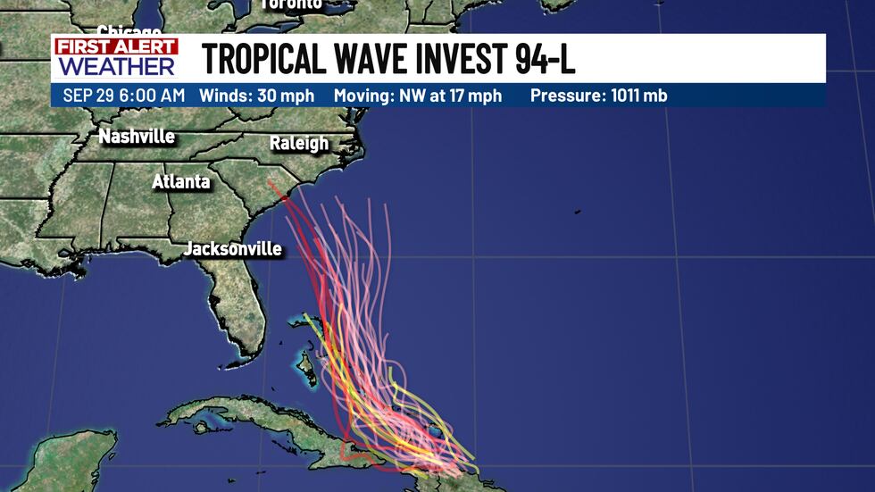
Out in the Atlantic there are two storms that could pose a threat to the U.S. One of these is Tropical Storm Humberto which is making its way slowly northwestward towards the south end of Bermuda and is expected to become a Category 3 hurricane by Sunday. The other is Invest 94-L which is crossing over the island of Hispaniola and has a 90% chance of tropical development once it passes the island and proceeds north over the Bahamas.
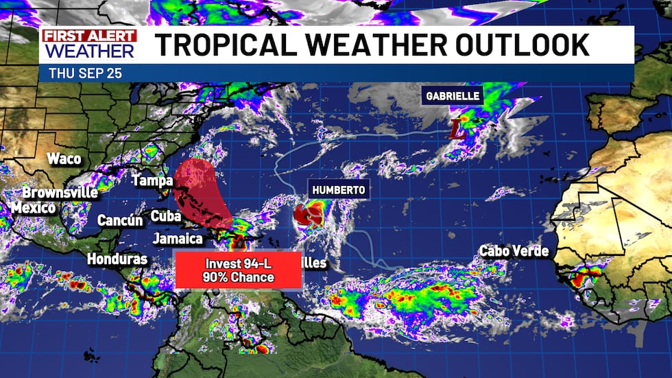
Of these two, Invest 94-L poses the greatest threat right now as model data shows a consistent trend of this system being guided into the coast of South Carolina or thereabout while model data of Tropical Storm Humberto prefers to have it turn back to the northeast before reaching the U.S. coast. Both of these storms will be closely monitored in the coming days.
Copyright 2025 KWTX. All rights reserved.


